Three Great Names, One Great Geospatial Team
Office Locations
Suite 1, Silvermine House
9 Silverwood Close, Steenberg Office Park
Tokai
Cape Town 7945
Phone: +27 2 1702 8940
(As of 28 November 2022)
Knightsbridge Office Park
33 Sloane Street
Building C, Second Floor
Bryanston
Johannesburg 2191
Phone: +27 11 467 2609
Contact

Industries
Mining
We support mine design and planning, rehabilitation monitoring, mineral exploration, and stockpile and pit volume calculations.
Power

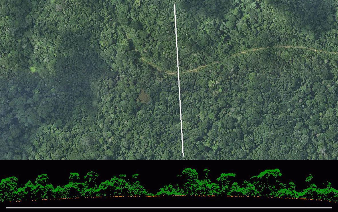
Our lidar can be used for power line detail mapping, alignment and profiling, as well as ampacity surveys.
Infrastructure
We perform dam site and river surveys, infrastructure design, subsidence monitoring, and site and corridor selection.
Agriculture and Environment
Our services support soil classification, vegetation monitoring and mapping, farm design and agri business.
Featured Clients

Pioneers of Aerial and Digital Mapping
1st
Lidar system in Africa
1st
Hyperspectral system in South Africa
1st
Terrain mapper in Africa
Level 2
B-BBEE Certified
9001:2015
ISO Certified